Usually in climbing, we obsess over how we get up a specific route.
However, it’s just as important to know how to get down.
One of the most frequently asked questions in this regard, is: How do climbers get down from El Capitan in Yosemite Valley?
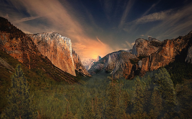
There’s 3 popular ways climbers get down from El Cap after they’ve ascended it: They may take the East Ledges Descent, The Yosemite Falls Trail or the Tamarack / Old Big Oak Flat Road. Each of these routes has it’s pros and cons.
For example, the East Ledges Descent is by far the quickest, but it’s also the most difficult and dangerous route. Below, we’ll cover the characteristics of these three popular ways that climbers use to get down from the mother of all climbing walls: El Capitan.
And yes, these are ways you can get down if you don’t have a kilometer long rappel rope, like these guys do:
The First Option: East Ledges Descent
- Fastest trail (by far)
- Steepest
- Involves rappelling
- Involves down climbing
- Most complicated / expert level
- Ends to the East of El Cap
This route is for experienced climbers. The East Ledges Descent is the most popular route amongst climbers. This is because it gets you back to the valley in the fastest manner.
The East Ledges Descent involves a steep hike down, followed by a vertical rappel. Those climbers who have ascended El Cap probably won’t have any issue with taking this route, but keep in mind that you do need to know what you’re doing when you’re planning on descending El Cap from the East Ledges side.
For this route, climbers start on the top of El Cap, and go to the East following the trees:
If you look at Google Maps, you can see that the natural geometry forms a path to the East. Climbers looking to get down from el Cap follow this path, until they get to the point where they can’t hike anymore.
That’s where the rappelling takes place. I’ve pinpointed the location roughly on this map where you have to rappel:
As you can see, it’s where the path formed by the natural geometry ends (Zoom out to see it clearer). From here on, there’s no other way to get down but by rappelling.
Here’s the rough GPS data of where climbers rappel down when descending El Cap following the East Ledges route: 37.733074, -119.624149.
Second option: Yosemite Falls Trail
- Start at the Snow Creek Trail
- Steep hike down the Yosemite Falls Trail
- Ends at Camp 4, near a parking lot, to the East of El Cap
If you don’t feel like rappeling, of course hiking is still an option. One of the most popular hikes down El Cap, is the Yosemite Falls Trail.
Get off the Snow Creek Trail on the Yosemite Falls trail at this GPS location: 37.759595, -119.599194.
Have a look at the Snow Creek Trail on Google Maps here:
When taking the Snow Creek trail to complete the Yosemite Falls Hike down off El Cap, you first walk to the East from El Cap. Simply follow the road and leave Eagle peak on your right as you pass by it, continuing your way to the Yosemite Falls.
Here’s the Yosemite Falls on Google Maps:
As you can see, once you’re at Yosemite Falls, you’ll be able to hike down on the West side of Yosemite Falls, zigzagging your way down, and from thereon continue down to the valley to get back to the base of El Cap.
Third Option: Tamarack Flat
- Less steep
- Longer hike
- Ends West of El Cap
A longer route climbers sometimes take to get down from El Cap, is the Tamarack Flat. Especially if they’ve set up camp to the west of El Cap, this can be a better option than taking the East Ledges or the Falls trail.
Because it’s a longer hike, it’s also a lot less sloped.
This route ends at the Tamarack Flat Campground. At first you’ll descend down a foresty path. Before you’ll get to the second forest section, you’ll hike down through a more open space, so in the summer it’s imperative that you bring enough water with you.
At the end of the trail, as you approach the camp, you need to prepare for a slight upwards hike.
All in all, the Tamarack trail is one of the longer hikes down. It can be challenging on it’s own, so it may be a tiresome option if you’re exhausted by summiting El Cap. If your ascension of El Cap took a lot of time, you may opt for a shorter route so as to prevent walking through in dark. Then again, it is probably safer than rappelling down after dusk.
Keep in mind that the Tamarack route is closed during December to May, because the Tamarack Campground is closed during this period of the year.
Fourth Way: Old Big Oak Flat Road
- It’s about a 6.5 miles hike
- Ends West of El Cap
Alternatively, you can take the Old Big Flat Road, which is a westward hike down El Cap, just like the Tamarack hike.
You can find the Old Big Flat Road on Google Maps here:
Once you find the roads, It’s pretty clear where to go. Just make sure not to stay off the road, especially to the South, to avoid unexpected steep cliffs.
Other ways to get down
There’s a couple of static ropes set up as well on El Cap, which climbers sometimes use to get down. It’s best to make sure you bring your own rappelling equipment to get down though, as it’s not guaranteed that you can use these lines.
In case of an emergency, sometimes a helicopter is an option as a last resort. Needless to say, you don’t want to plan for taking this ride home.
The Bottomline
So in conclusion, now you know how climbers get off El Cap!
They typically don’t rappel down the same way they came. If they do rappel, they’ll usually go for the East Ledges Descent. Alternatively, climbers will hike using either the Yosemite Falls route, or the Old Big Oak or Tamarack Flat hike routes.

